Ecw
Advertisement
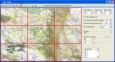
ER Viewer v.7 2
ERDAS ER Viewer is an easy-to-use image viewer which can a read most other common file types, featuring interactive roaming and zooming with very large JPEG 2000 and ECW files. ERDAS ER Viewer can print to common large-format printers.
Advertisement
ERDAS ER Viewer 2011 & Microsoft v.11.0.0.250
ERDAS ER Viewer is a free, easy-to-use image viewer featuring interactive roaming and zooming with very large JPEG 2000 and ECW files. It can also read most other common file types.
OkCustomMap v.1.0.0
OkCustomMap is a software to produce Garmin Custom Maps. Supports many map formats, JPEG quality, KML transparency, draw order, image scaling and filters. You can customize the size of the tiles or the tiles number horizzontally or vertically.
GeoVisu v.5.0.1
GeoVisu is a program that displays georeferenced data (images, graphics) and downloads data recorded by some GPS devices. GeoVisu has a 'Moving map' navigation function, which can be used with any NMEA 0183 compatible or Garmin USB GPS device.
Getmapping Viewer v.2.0.0.1
Getmapping Viewer is an easy to use aerial photo and mapping viewer featuring interactive roaming, zooming, measuring tools and more. Main features: - Save imagery as TIFF, JPEG, BMP, ERS, and BIL directly from ER Viewer.
ERDAS APOLLO Image Web Server 2011 v.11.0.1.250
ERDAS APOLLO Essentials - Image Web Server is a high-speed, specialized application that efficiently distributes massive amounts of geospatial imagery to thousands of users, all from a single server.
GPS Pathfinder Office v.5 20
Powerful and easy to use GPS data processing software The GPS Pathfinder Office software is a powerful and easy-to-use software package of powerful GNSS postprocessing tools, incorporating the new Trimble DeltaPhase differential correction techno
ERDAS ECWJP2 SDK Desktop Read-Only v.4.2.1.182
Solve the problems associated with handling large imagery datasets.
SpacEyes3D Viewer v.5.0
Real time 3D visualization of terrain model, and DTM analysis. SpacEyes3D Viewer is program to interactively visualize 3D models made with SpacEyes3D Builder.SpacEyes3D Viewer uses the same rendering engine that SpacEyes3D Builder.
Geosoft Desktop Cataloger v.7.5.1
The Geosoft Desktop Cataloger is a free utility that helps you build a catalog of your spatial files from your local drives, and lets you easily find that data when using Geosoft exploration software (Oasis montaj, Target) or Geosoft exploration soft
Free Shapefile Viewer v.5.3.1
The free AvisMap Viewer opens most GIS/CAD and raster image file types and most ArcView, ArcExplorer, and MapInfo projects.